London Population | Growth, Density & Home Ownership Statistics
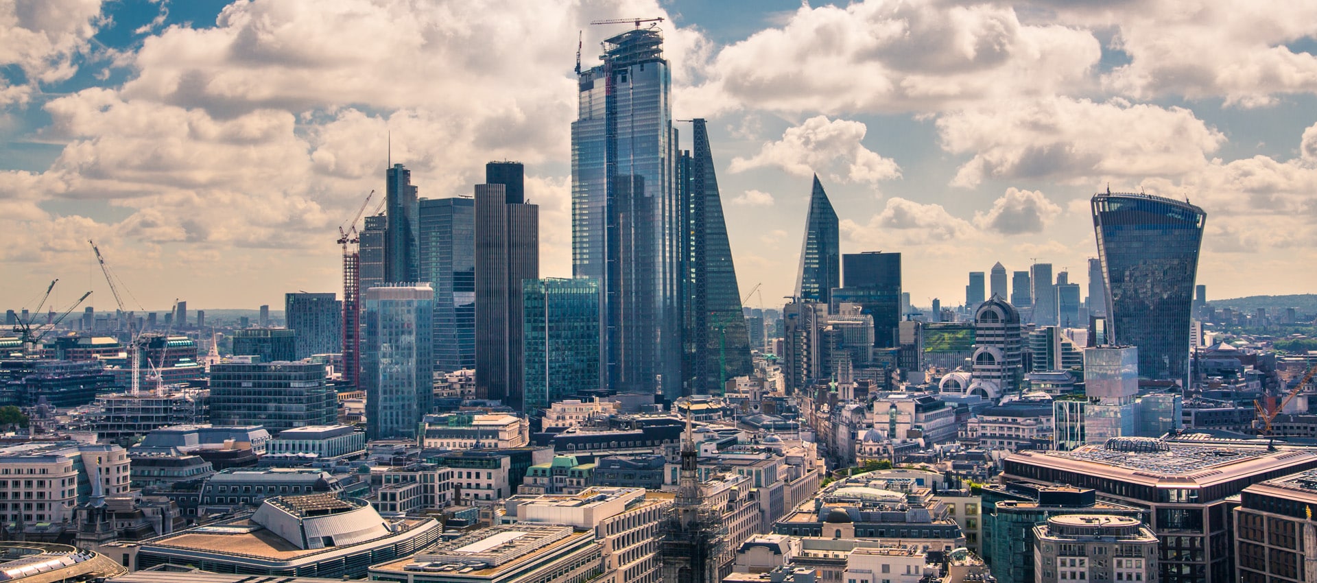
London is the UK's biggest property market by a distance, and the 2021 Census counted nearly 8.8 million people across its 33 boroughs. That is 7.1% more than in 2011, but the headline number hides the real story: the capital is pulling in two directions at once.
The outer boroughs are growing fast. Tower Hamlets added 22.1% and Barking and Dagenham 17.7%. Central London, meanwhile, is shrinking. Westminster lost 6.9% of its residents over the decade, Kensington and Chelsea 9.6%, and Camden 4.6%. For anyone weighing up a London buy-to-let, that split between a busy outer ring and a hollowing-out centre is the first thing to understand.
Article updated: July 2026
London also rents more than anywhere else in the country. Just 46.7% of households own their home, against 62.3% nationally, and private renting runs at 30.1% versus 20.6% across England. The tables below break the 2021 Census down by every London postcode and borough, so you can see where the people, the renters and the density actually sit, whether you buy in the capital or look further out to the London commuter belt.
London Population by Borough and Postcode
This table sets out the 2021 Census for every London postcode, grouped by borough and ranked by population within each. The inner-city postcodes carry the highest densities, with Elephant and Castle (SE17) topping 48,000 people per square mile, while the outer boroughs spread similar numbers over far more ground. Watch the density column to see where the capital is most tightly packed.
Barking and Dagenham
Postcode
Area
Population (2021)
Households
Density (per sq mile)
IG11
Barking
50,081
18,064
17,647
RM8
Becontree
38,998
14,839
24,455
RM10
Dagenham
37,850
14,605
19,507
RM9
Dagenham
35,449
13,392
13,928
RM6
Chadwell Heath
32,908
12,193
9,006
RM7
Romford
27,411
11,075
12,054
RM5
Collier Row
19,022
7,564
15,295
Barnet
Postcode
Area
Population (2021)
Households
Density (per sq mile)
EN5
Barnet
37,049
15,193
5,968
NW11
Golders Green
32,571
11,870
16,636
NW4
Hendon
31,745
11,510
15,249
N12
North Finchley
28,741
11,454
17,948
N10
Muswell Hill
27,532
11,308
18,916
N3
Finchley
26,584
10,470
17,452
EN4
Barnet
25,767
10,077
5,987
NW7
Mill Hill
25,131
9,375
7,165
N2
East Finchley
23,878
9,608
13,044
N20
Whetstone
18,967
7,284
8,731
Bexley
Postcode
Area
Population (2021)
Households
Density (per sq mile)
DA16
Welling
35,896
13,636
16,173
DA7
Bexleyheath
34,811
13,909
14,442
DA8
Erith
32,927
12,927
12,128
DA15
Sidcup
29,123
11,279
13,616
DA14
Sidcup
21,876
9,681
7,761
DA5
Bexley
20,525
8,158
6,610
DA17
Belvedere
17,128
6,939
11,817
DA6
Bexleyheath
10,053
4,120
10,770
DA18
Thamesmead
4,851
1,920
12,974
Brent
Postcode
Area
Population (2021)
Households
Density (per sq mile)
NW10
Willesden
91,820
34,410
18,402
NW2
Cricklewood
67,393
25,716
21,704
NW6
Kilburn
62,056
28,504
35,370
NW9
Colindale
59,320
20,291
18,265
HA0
Wembley
48,613
14,984
20,964
HA9
Wembley Park
47,505
15,578
19,371
Bromley
Postcode
Area
Population (2021)
Households
Density (per sq mile)
BR1
Bromley
55,931
23,202
12,398
BR3
Beckenham
47,386
21,124
10,385
BR6
Orpington
46,065
18,982
3,806
BR5
Orpington
45,923
18,903
8,877
BR2
Bromley
44,903
18,993
5,610
SE20
Penge
22,821
10,461
23,410
BR8
Swanley
22,044
9,182
4,592
BR4
West Wickham
19,349
7,384
8,953
BR7
Chislehurst
17,322
7,079
5,490
Camden
Postcode
Area
Population (2021)
Households
Density (per sq mile)
NW1
Camden
60,294
26,142
25,578
NW3
Hampstead
51,644
23,675
19,533
NW5
Kentish Town
30,948
13,197
35,139
City of London
Postcode
Area
Population (2021)
Households
Density (per sq mile)
EC2
Liverpool Street
4,695
2,786
16,435
EC4
Blackfriars
1,181
795
8,953
EC3
Aldgate
395
232
6,275
Croydon
Postcode
Area
Population (2021)
Households
Density (per sq mile)
CR0
Croydon
153,803
61,879
12,838
CR2
South Croydon
48,427
19,825
9,088
CR7
Thornton Heath
44,620
16,261
28,071
SE25
South Norwood
34,495
14,941
21,755
CR8
Purley
32,301
12,328
6,765
CR5
Coulsdon
28,761
11,045
3,377
CR3
Caterham
28,748
11,694
3,066
SE19
Crystal Palace
27,638
12,688
16,753
CR6
Warlingham
9,881
4,038
1,575
Ealing
Postcode
Area
Population (2021)
Households
Density (per sq mile)
UB6
Greenford
50,948
17,331
13,473
W3
Acton
50,534
20,131
20,330
W5
Ealing
49,952
20,537
16,246
UB3
Hayes
48,474
16,057
13,355
UB5
Northolt
45,158
16,515
16,755
UB1
Southall
39,848
11,271
18,082
UB2
Southall
32,044
9,557
15,830
W13
West Ealing
31,771
13,108
23,938
W7
Hanwell
28,739
11,065
19,203
Enfield
Postcode
Area
Population (2021)
Households
Density (per sq mile)
EN3
Enfield
55,687
20,585
14,155
N9
Edmonton
51,422
19,260
20,447
EN1
Enfield
45,671
17,862
14,628
N13
Palmers Green
31,681
12,275
19,740
N18
Upper Edmonton
31,598
11,300
21,387
EN2
Enfield
29,471
12,612
4,591
N21
Winchmore Hill
23,578
9,274
10,651
Greenwich
Postcode
Area
Population (2021)
Households
Density (per sq mile)
SE18
Woolwich
75,840
29,245
19,534
SE13
Lewisham
40,848
17,849
27,051
SE3
Blackheath
31,311
13,918
13,830
SE28
Thamesmead
29,318
10,497
14,322
SE12
Lee
27,353
11,576
12,719
SE2
Abbey Wood
26,672
10,135
15,254
SE10
Greenwich
23,744
10,714
24,115
SE7
Charlton
20,399
7,979
14,551
Hackney
Postcode
Area
Population (2021)
Households
Density (per sq mile)
N1
Islington
89,893
41,092
38,774
N16
Stoke Newington
68,432
26,197
37,831
E5
Clapton
47,669
18,830
34,096
E2
Bethnal Green
46,216
19,208
43,853
E8
Dalston
39,071
17,168
39,808
E9
Homerton
38,236
15,900
26,100
Hammersmith and Fulham
Postcode
Area
Population (2021)
Households
Density (per sq mile)
SW6
Fulham
64,994
28,492
31,865
W12
Shepherd's Bush
48,273
20,107
26,496
W14
West Kensington
37,166
17,669
37,984
W6
Hammersmith
35,669
15,841
30,860
Haringey
Postcode
Area
Population (2021)
Households
Density (per sq mile)
N17
Tottenham
62,843
23,385
25,748
N4
Finsbury Park
46,277
20,094
35,386
N15
Seven Sisters
44,541
16,783
32,439
N22
Wood Green
42,996
17,154
22,101
N8
Crouch End
39,673
17,208
22,799
N6
Highgate
19,407
8,905
14,508
Harrow
Postcode
Area
Population (2021)
Households
Density (per sq mile)
HA3
Kenton
70,809
23,415
15,470
HA8
Edgware
64,905
22,389
14,739
HA2
North Harrow
55,273
19,214
17,970
HA5
Pinner
44,534
17,478
9,557
HA1
Harrow
38,441
14,182
15,996
HA7
Stanmore
35,976
12,758
9,511
Havering
Postcode
Area
Population (2021)
Households
Density (per sq mile)
RM3
Harold Hill
40,267
16,854
9,880
RM12
Hornchurch
34,603
14,161
13,372
RM11
Hornchurch
31,338
12,365
11,082
RM13
Rainham
28,416
11,385
3,568
RM14
Upminster
26,905
10,842
1,322
RM1
Romford
20,053
8,622
12,706
RM2
Gidea Park
13,240
5,646
12,900
RM4
Havering-atte-Bower
4,290
1,804
2,333
Hillingdon
Postcode
Area
Population (2021)
Households
Density (per sq mile)
HA4
Ruislip
50,092
19,437
10,037
UB3
Hayes
48,474
16,057
13,355
UB4
Yeading
39,573
13,294
13,843
UB8
Uxbridge
36,116
12,680
12,708
UB10
Hillingdon
33,615
12,519
8,026
UB7
West Drayton
29,741
11,098
7,048
HA6
Northwood
21,901
8,809
4,860
UB9
Denham
14,336
5,979
2,153
Hounslow
Postcode
Area
Population (2021)
Households
Density (per sq mile)
W4
Chiswick
44,335
19,885
17,746
TW3
Hounslow
39,554
13,394
26,209
TW7
Isleworth
37,586
14,502
16,942
TW13
Feltham
36,127
13,887
12,342
TW5
Heston
29,196
9,278
15,463
TW14
Hatton
27,980
10,401
11,653
TW4
Hounslow
27,899
9,139
17,884
TW8
Brentford
19,673
8,562
15,653
Islington
Postcode
Area
Population (2021)
Households
Density (per sq mile)
N7
Holloway
46,850
20,847
38,387
N19
Archway
33,784
15,114
36,904
EC1
Clerkenwell
27,082
13,224
32,637
N5
Highbury
24,725
11,308
38,034
Kensington and Chelsea
Postcode
Area
Population (2021)
Households
Density (per sq mile)
W10
Ladbroke Grove
33,638
14,649
23,275
W11
Notting Hill
31,354
15,349
30,122
SW3
Chelsea
22,086
11,745
21,566
W8
Kensington
20,390
9,441
25,274
SW7
South Kensington
19,583
9,146
18,929
SW10
West Brompton
18,510
9,347
36,429
SW5
Earls Court
15,272
8,233
45,088
Kingston upon Thames
Postcode
Area
Population (2021)
Households
Density (per sq mile)
KT3
New Malden
38,055
14,189
13,187
KT2
Kingston upon Thames
31,551
12,470
10,610
KT6
Surbiton
31,378
13,423
15,669
KT4
Worcester Park
28,680
11,340
12,948
KT1
Kingston upon Thames
21,979
9,256
17,269
KT5
Surbiton
20,856
8,183
13,813
Lambeth
Postcode
Area
Population (2021)
Households
Density (per sq mile)
SW16
Streatham
81,543
32,169
23,132
SW2
Brixton
54,204
23,095
35,239
SW9
Stockwell
42,067
18,051
41,872
SW4
Clapham
39,633
17,099
32,448
SW8
Nine Elms
35,138
15,634
35,257
SE11
Kennington
21,589
9,615
34,141
SE27
West Norwood
21,358
8,859
23,538
SE24
Herne Hill
18,761
7,796
22,141
SE21
Dulwich
15,257
6,069
9,546
Lewisham
Postcode
Area
Population (2021)
Households
Density (per sq mile)
SE15
Peckham
63,647
25,387
31,322
SE6
Catford
53,011
21,172
20,483
SE23
Forest Hill
33,682
14,629
21,886
SE4
Brockley
28,595
11,864
23,797
SE26
Sydenham
28,455
12,506
19,687
SE8
Deptford
27,490
11,577
34,673
SE14
New Cross
24,781
9,972
27,140
Merton
Postcode
Area
Population (2021)
Households
Density (per sq mile)
SW19
Wimbledon
77,441
32,804
22,912
SW17
Tooting
64,566
25,928
27,223
SM4
Morden
36,292
13,783
16,581
SW20
Raynes Park
28,402
11,682
14,713
Newham
Postcode
Area
Population (2021)
Households
Density (per sq mile)
E6
East Ham
78,955
24,340
24,255
E7
Forest Gate
54,565
16,334
37,681
E15
Stratford
52,199
19,564
26,834
E3
Bow
51,618
20,152
38,835
E13
Plaistow
46,912
15,569
38,980
E16
Canning Town
44,880
17,163
19,084
E12
Manor Park
41,869
12,572
24,052
E20
Stratford
0
0
0
Redbridge
Postcode
Area
Population (2021)
Households
Density (per sq mile)
IG1
Ilford
63,569
19,899
26,559
E11
Leytonstone
55,128
21,725
18,380
IG8
Woodford Green
35,894
14,254
7,523
IG3
Seven Kings
35,543
11,018
23,919
IG2
Gants Hill
28,254
9,291
20,147
IG6
Barkingside
27,822
10,716
13,845
IG7
Chigwell
19,991
7,789
3,698
E18
South Woodford
19,022
8,136
19,370
IG5
Clayhall
16,823
5,713
18,649
IG4
Redbridge
9,455
2,953
21,419
Richmond upon Thames
Postcode
Area
Population (2021)
Households
Density (per sq mile)
TW2
Twickenham
30,276
12,225
13,768
TW1
Twickenham
26,065
11,233
14,636
TW12
Hampton
23,227
9,829
9,751
TW11
Teddington
23,198
10,003
9,534
TW9
Kew
21,556
9,897
9,626
TW10
Richmond
19,291
8,535
5,739
SW14
Mortlake
16,714
7,019
17,084
SW13
Barnes
15,873
6,697
11,530
Southwark
Postcode
Area
Population (2021)
Households
Density (per sq mile)
SE1
Waterloo
66,777
29,678
35,535
SE5
Camberwell
46,209
18,836
33,077
SE16
Rotherhithe
45,831
20,327
33,699
SE17
Elephant and Castle
31,522
13,057
48,587
SE22
East Dulwich
29,687
12,633
20,823
Sutton
Postcode
Area
Population (2021)
Households
Density (per sq mile)
SM1
Sutton
38,241
16,336
19,421
SM5
Carshalton
37,962
15,013
11,459
SM6
Wallington
36,166
15,048
13,898
SM2
Sutton
28,260
12,260
10,472
SM3
North Cheam
21,079
7,943
16,410
SM7
Banstead
18,502
7,265
4,216
Tower Hamlets
Postcode
Area
Population (2021)
Households
Density (per sq mile)
E1
Whitechapel
81,940
31,294
43,893
E14
Canary Wharf
79,760
33,339
40,570
Waltham Forest
Postcode
Area
Population (2021)
Households
Density (per sq mile)
E17
Walthamstow
102,968
38,408
28,017
E4
Chingford
60,225
23,890
9,367
E10
Leyton
42,953
15,235
28,007
Wandsworth
Postcode
Area
Population (2021)
Households
Density (per sq mile)
SW11
Battersea
70,152
31,222
30,346
SW15
Putney
60,344
25,547
12,140
SW18
Wandsworth
59,806
25,049
25,107
SW12
Balham
31,261
13,344
29,428
Westminster
Postcode
Area
Population (2021)
Households
Density (per sq mile)
SW1
Westminster
52,478
27,001
21,985
W2
Bayswater
47,574
23,538
35,885
W9
Maida Vale
37,724
17,573
44,192
W1
Mayfair
29,383
15,291
19,384
WC1
Bloomsbury
28,337
12,372
28,460
WC2
Covent Garden
6,478
3,340
15,150
Where London Is Growing and Shrinking
London's population is not moving in one direction. The fastest growth since 2011 came from the outer and eastern boroughs, led by Tower Hamlets (22.1%) and Barking and Dagenham (17.7%) on the back of new housing and younger residents.
Central London told the opposite story. Westminster, Kensington and Chelsea, and Camden all lost residents over the decade. Home ownership follows the same divide, ranging from 70.5% in Havering out east to just 25.7% in Tower Hamlets, while the highest private-rental rates sit in the City of London (48.4%) and Westminster (43.6%). It is the same divide we map borough by borough in our Property Investments UK guides.
Ready to buy property?
Browse investment properties with prices and gross yields shown for each opportunity.